SkyRadar is the first dedicated micro-climate weather forecast map for the landscape and astrophotography community in Vietnam. Plan sunset, sunrise, and Milky Way shoots with confidence.
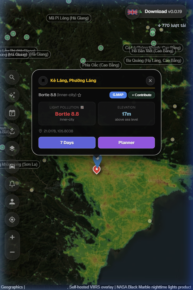
No more guessing standard weather apps. SkyRadar combines global atmospheric physics and astronomical algorithms to grade your shooting conditions hourly.
Calculates the probability of sunset and sunrise clouds catching vivid light by analyzing detailed cloud layer structures, horizontal visibility, and solar angles.
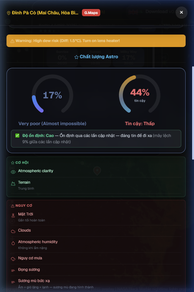
Built for astrophotographers and Milky Way hunters. Evaluates the sky darkness and atmosphere transparency at your exact GPS coordinates.
Designed to protect your gear and help you compose the perfect landscape shot ahead of time.
Plan ahead for long roadtrips. SkyRadar shows a breakdown of hourly scores, 3-tier cloud ratios, precipitation metrics, wind speeds, and potential severe hazards.
Try web map now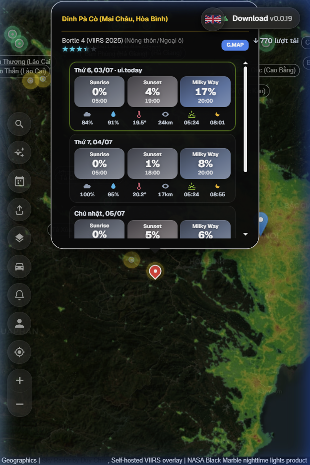
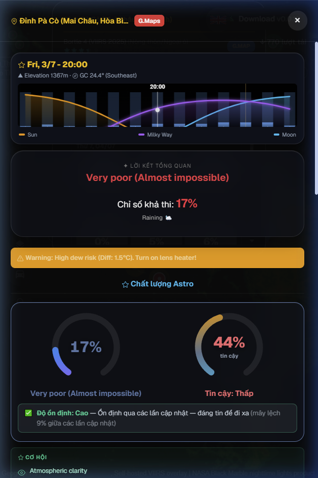
Ditch third-party astronomy apps. SkyRadar features an integrated **Galactic Center Tracker**, overlaying the Milky Way's elevation, azimuth, and rise time directly on your selected coordinates so you can pre-visualize your composition.
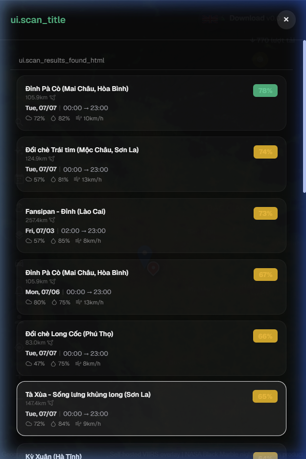
Have an unexpected free weekend and want to travel? Click the scanner. SkyRadar will sweep curated photography locations within 500km and find exactly which spot has the clearest sky tonight.
Protect your expensive camera lenses. SkyRadar tracks the dew point margin to send **Dew Risk** warnings, reminding you to attach a lens heater. Severe wind gusts warnings are also visible to ensure tripod stability during long exposures.
Landscape Photographer & Software Engineer
SkyRadar was born from the pure frustration of missed shots in the field. Combining years of landscape astrophotography experience with technical engineering, Duy Chris built and continuously calibrates these custom scoring models to fit the tropical micro-climate patterns of Vietnam.
Answers to common questions about SkyRadar's calculations and setup.